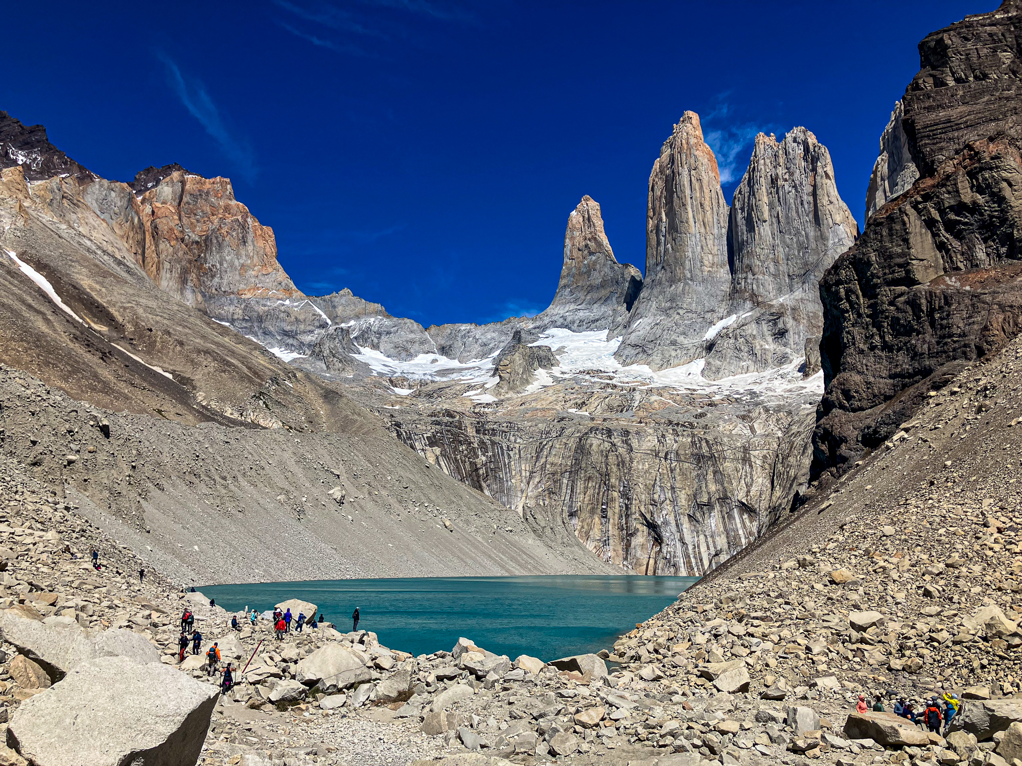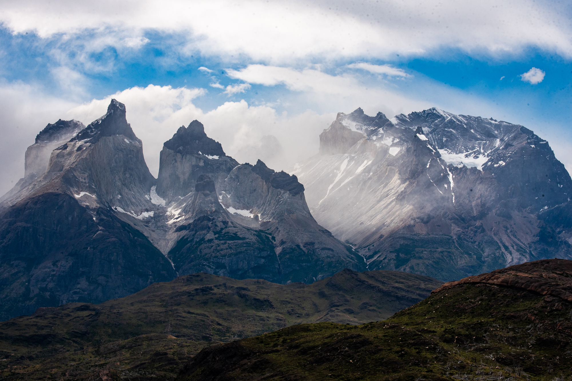

Patagonia was the driving motivation behind the trip to Chile, and with good reason. But Chile is an incredibly varied country, and its unique shape means we had no shortage of options to extend our trip after leaving Patagonia: wine country, Santiago, the desert, the beach? Hop over the high Andes to Argentina or Bolivia?
The Atacama desert started to seem the most appealing, and San Pedro de Atacama initially was the natural choice – a frequent stop for backpackers in South America, and one that came highly recommended by friends. But the double-edged sword, as with all popular destinations, is that touring around San Pedro can get crowded. So we kept looking, and settled on Chile’s far north, where the international tourism market is primarily overlanders going to/from Peru and the occasional cruise ship.
It ended up unquestionably being the correct choice.

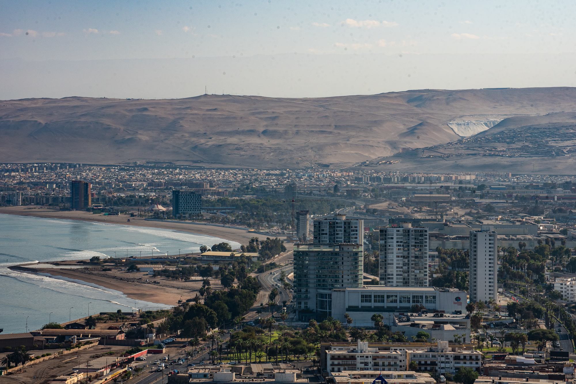
After leaving Patagonia, we connected straight through Santiago to Arica, the capital of Chile’s northernmost region. Arica is closer to Peru and Bolivia than to the next Chilean city (Iquique), and is the driest city in the world. It lies at the delta of a river valley between steep oceanside cliffs, underneath an imposing rock called the Morro of Arica.
After spending a night at the Hotel Plaza Colón, our tour guide picked us up for four days of travel through the altiplano, heading up from sea level to eventually make it above 15,000’ altitude. Iván, our tour guide (Arica Unlimited), had entirely customized the tour according to our interests. He is also a Chilean birding champion, which was very promising.
Day 1

We spent the morning visiting sites around Arica. We went up to el Morro, where we could look out over the city and the Pacific Ocean. Iván also took us out of the city to both the south and north coasts, where we saw lots of birds and got a better sense of Arica. We walked through the main market of the city, where vendors sold produce, clothes, electronics, and more.
The final stop before heading up into the mountains was for lunch, which was freshly caught fish at a restaurant on the water, right near the city’s main port. After eating, we made our way into the Atacama desert, which spans virtually all of the northern Chilean lowlands. Following a quick stop to see 11,000-year-old (!) mummies at the San Miguel de Azapa archeological museum, we headed east on Highway 11, away from the city.

For 100 kilometers, the highway follows the Lluta river valley as it slices through the desert, which makes for astonishing landscapes as you look down into a narrow green strip at the foot of steep, arid mountains of sand. The bulk of the traffic is Bolivian trucks, with a notable number of fuel tankers, as Arica and Antofagasta are the two primary ports for Bolivian shipping. Though the highway is a major international trucking route, there was minimal passenger traffic. This stretch through the desert also steadily climbs high into the Andes – I kept nodding off in the back seat from the hot sun combined with the falling oxygen levels.
In Zapahuira (11,000’), the Atacama turns into the altiplano, and the highway turns into a seemingly nonstop series of switchbacks. The landscape was now dotted with vegetation and high peaks, and the air was notably thinner.

The final part of the first day’s drive was 30 kilometers from Zapahuira to Putre (11,500’). Unfortunately, a substantial stretch of that was under construction to widen the highway, which meant that it closed for several hours in the afternoon. Iván knew this and had planned the drive to coincide with the scheduled reopening – the sign indicated that traffic would start moving again at 5 p.m. – but we ended up waiting over two hours until 7:30 before continuing onto Putre. There was an astonishing lineup of trucks winding down the highway as everyone waited for the road to open.
Eventually we got moving again, sat down for dinner in Putre, and checked into the Hotel Q’antati, which offered beautiful accommodations and real (not instant) coffee – far from the norm in the altiplano.

Day 2
After a large breakfast, we returned to the van and continued climbing up Highway 11. The altitude was now steadily increasing again and we were all feeling the effects. I had previously been above 14,000’ on several occasions, including for multiple days at a time, but never without an acclimatization period – we traveled from sea level to over 15,000’ in less than 24 hours, and the experience was dizzying.

Despite the oxygen shortage, we marveled at the stunning views in the chilly morning air. A bit up the road, we officially entered Lauca National Park which, along with the adjacent Las Vicuñas Reserve and Sajama National Park in Bolivia, accounts for a huge protected area in this region of the Andes. The landscape is dominated by two snow-capped volcanoes collectively called Payachata (twins in Aymara), and the Nevado Sajama over the border in Bolivia, all more than 20,000’ high. The lowlands – relatively speaking – consist mostly of shrubland, bofedales (peat marshes), and small ponds.
Our first stop was for a short walk at Las Cuevas, where there is evidence of human habitation from thousands of years ago, visible in how the rocks are arranged and remnants of fire. There were vizcachas everywhere basking in the sun, and the mice they rely on for food were scurrying around.

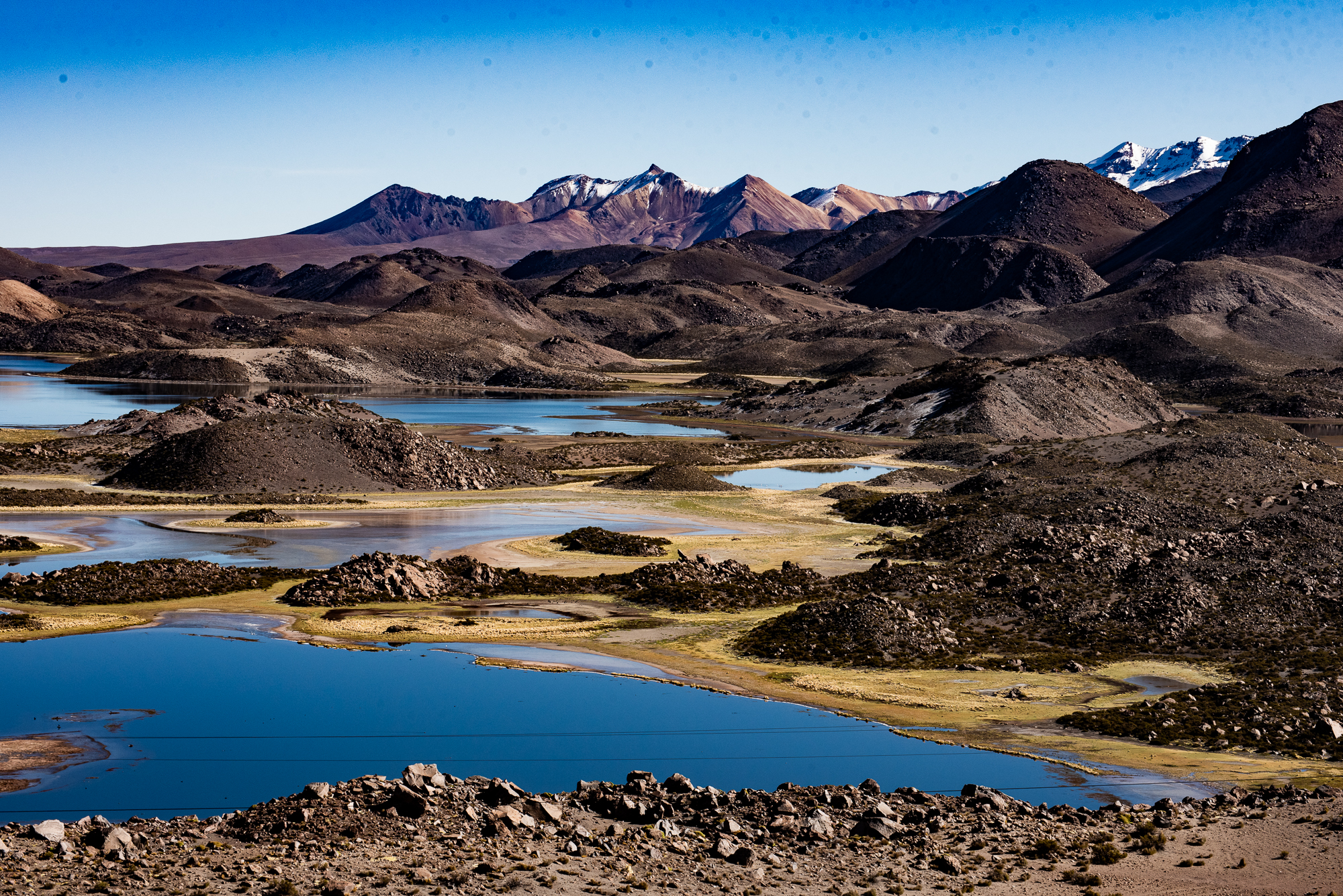
Further on, we pulled over at the Mirador Cotacotani. A herd of vicuñas was nervously trying to cross the highway, and flamingos stood in a small lake with a snow-covered backdrop. This was a preview of what was to come: after crossing one of the highest points on a paved road in Chile (15,200’), we stopped at Chungará Lake to see one of the most jaw-dropping landscapes I’ve ever witnessed. Dozens of bird species waded in and flew over the still blue water, with the volcano Parinacota towering behind and the Nevado Sajama in the distance.
The altitude had become extremely strenuous, and even the short walk down to the lakeside was exhausting. It was birding heaven, yet hard to find the energy to identify all the species. After a short time marveling at the view, we piled back in the van to descend a bit and head to the town of Parinacota.

After admiring a 1600s-era church in Parinacota and grabbing lunch at a small roadside restaurant, we visited one of Iván’s friends in the altiplano, shepherd Don Alberto. The alpacas were off somewhere else grazing, but he did have an adorable four-day-old goat. The kid’s mother was not happy when we were holding him!
We went to see an odd geological feature called the Devil’s Crater, and finally made it to Doña Julia’s alpaca farm (13,500’), where we would spend the evening. She had hundreds of alpacas, kept for both meat and wool, but one alpaca named Copito was her pet and lived by the house. He came right up to us and got in our faces, sniffing around and rubbing up against us – kind of like my cat at home. I’d never pet an alpaca before, and it was incredible to feel my hand sink into his layers of thick fur.
Doña Julia prepared an unbelievable two-course dinner: soup with potato, alpaca, and pumpkin; followed by a plate with quinoa, rice, alpaca, and chicken. The food was incredible, as were the stars outside. Staying on her farm was an unmatched experience, in the middle of the Altiplano with nobody else around for miles except the hundreds of alpacas outside.

Day 3
After breakfast with Doña Julia, we stopped at a small hot spring in a secret location – it’s on private property, and Iván had special permission to visit, so I don’t want to give anything away.
After lunch and a visit to see the ruins of a chacu – an ancient method to corral animals as a hunting technique – we returned to the lower altitude of Putre and the hotel Q’antati. I went for a run (which wasn’t easy) and we went back to the same restaurant as the first night. It had been an exhausting couple of days with the extreme altitude, and we all welcomed a day with some time to rest.

Day 4
We left Putre in the morning for the long drive back down to the coast. After another wait at the highway cut, we stopped for a birding walk in the small town of Socoroma and walked through the center of town. It was a beautiful, picturesque farming town with few facilities outside of the central church.

We then began the descent down through the Andes, stopping at the edge of the Atacama in Zapahuira for lunch. Other than a few roadside stops where Iván pointed out some historical and contemporary landmarks, we rapidly made our way back down to the Pacific, where he dropped us off at the hotel. We spent an additional couple of days in the city, which I wrote about here.
Chile’s northernmost region was astonishing. I leave every trip feeling fulfilled and with a renewed sense of wonder toward the Earth – but Arica & Parinacota floored me in a way I’ve rarely experienced. It is a little-traveled region that we were fortunate enough to see through the eyes of a guide who not only knew the terrain extraordinarily well, but personally knew and cared about the people we met. Looking up at the Milky Way from Doña Julia’s farm, I felt a million miles away from everyone I know and yet so close to the rest of the galaxy.

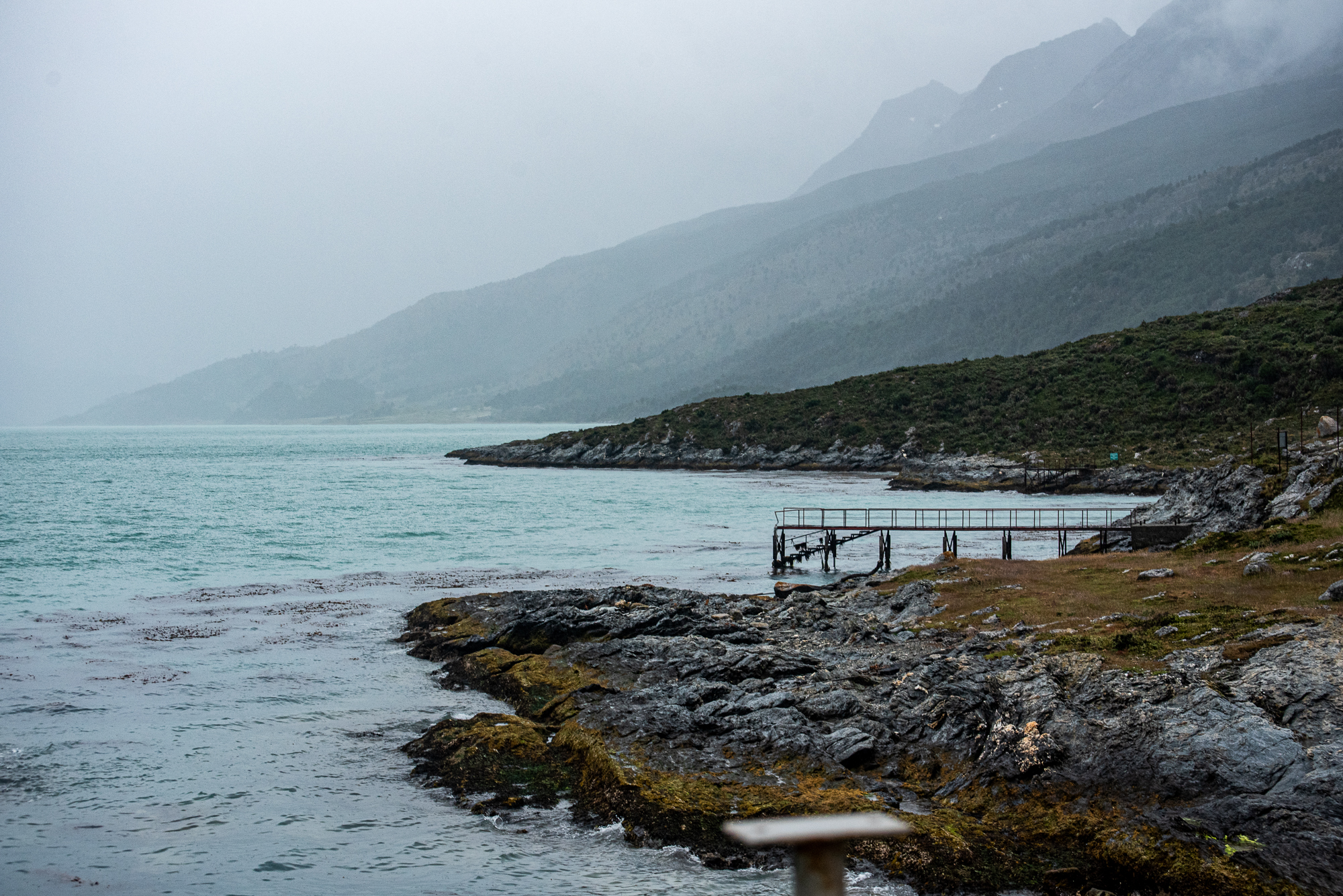
The landscape was unique, particularly seeing the transformation from desert to altiplano, and one truly special part was that I didn’t quite know what to expect. We had traveled to Arica from southern Chile (read about that here), where the mountains were likewise magnificent, but I had seen photos of them before and didn’t experience the sense of awe that the Payachata and Chungará Lake inspired. Flamingos wading amid a backdrop of snow capped volcanoes was truly breathtaking. And it wasn’t just the altitude.